
It is easy to think of war as something too large to be held. Then one comes across the papers which brought it indoors: a folded map, a thin government booklet, a ration book with a name written on its cover. None of them claims to contain the whole event. Each reduces it to a form that can be read, carried, shown across a counter or put away in a drawer.
There is a small family reason I find this kind of paper difficult to pass by. We only learned in 2016, long after my grandfather had died, that he had worked at Bletchley Park during the Second World War. The discovery came too late for the questions one would naturally ask. I do not look at these objects hoping to find a hidden connection to him. Rather, they make me imagine the conditions around work that was so often unseen: information arriving as paper, being ordered, carried, read carefully and then, in so many cases, kept quiet.
These three objects do not belong to one person or one story, and I do not want to force them into a false family. What they share is a particular kind of nearness. The map turns a vast conflict into a printed geography; the Command Paper offers an official account of the crisis of September 1939; the ration books show how controls continued to reach into ordinary life long after the fighting had ended. Together they show how wartime information and post-war controls reached people through maps, official pamphlets and ration books.
A map for the table
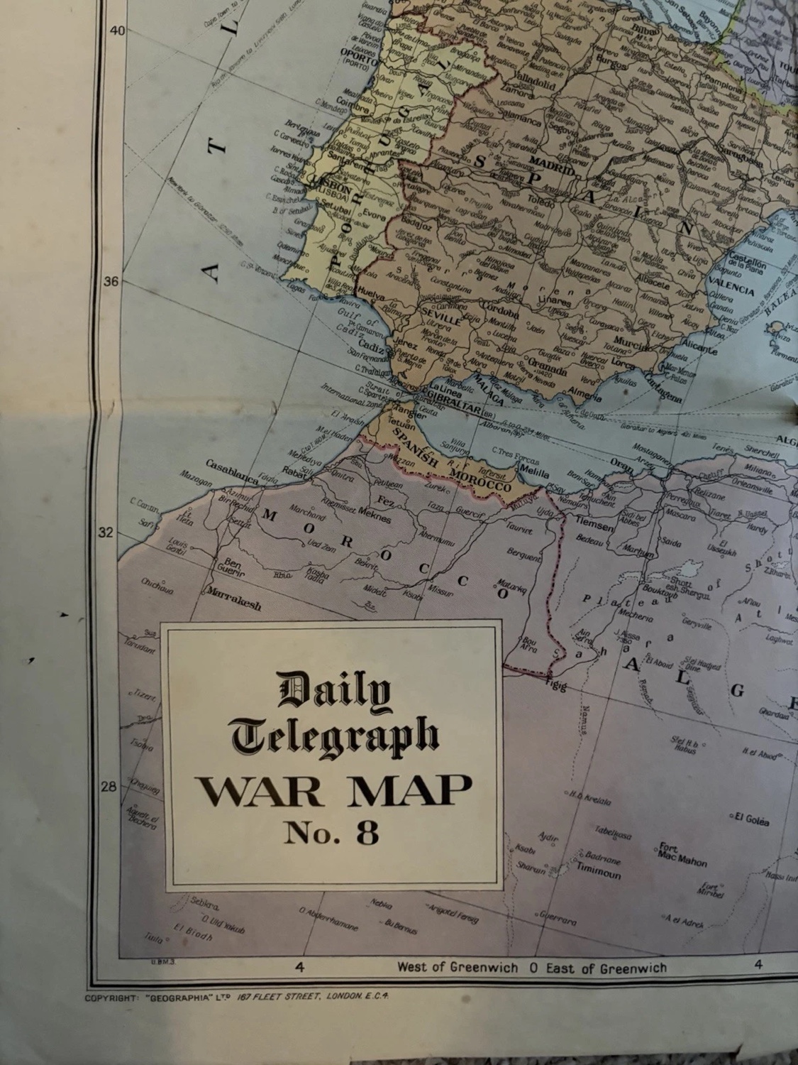
The Daily Telegraph War Map No. 8 is the first object that stopped me. It gathers Europe, Russia and North Africa onto one large sheet. Even in the photograph, one can feel that this is not a neat pocket atlas, but a printed surface made to be opened and looked across.
What holds the eye is the way the title sits inside the geography. Daily Telegraph War Map No. 8 is printed in a boxed panel at the edge of the sheet, beside a world of borders, coastlines and place names. The map does not need an arrow or a dramatic illustration to make its point. Its promise is simpler: here is the field of view; here are the names you have been hearing; now you may try to place them.
I like the slight inadequacy of that promise. A map can make a conflict look legible, but it cannot contain the uncertainty of news, movement or loss. The folds and the sheer size of this one make that tension visible. It is a map intended to be useful, yet it has also become a record of how a newspaper imagined the reader’s need to understand events far away.
When the paper is the official voice
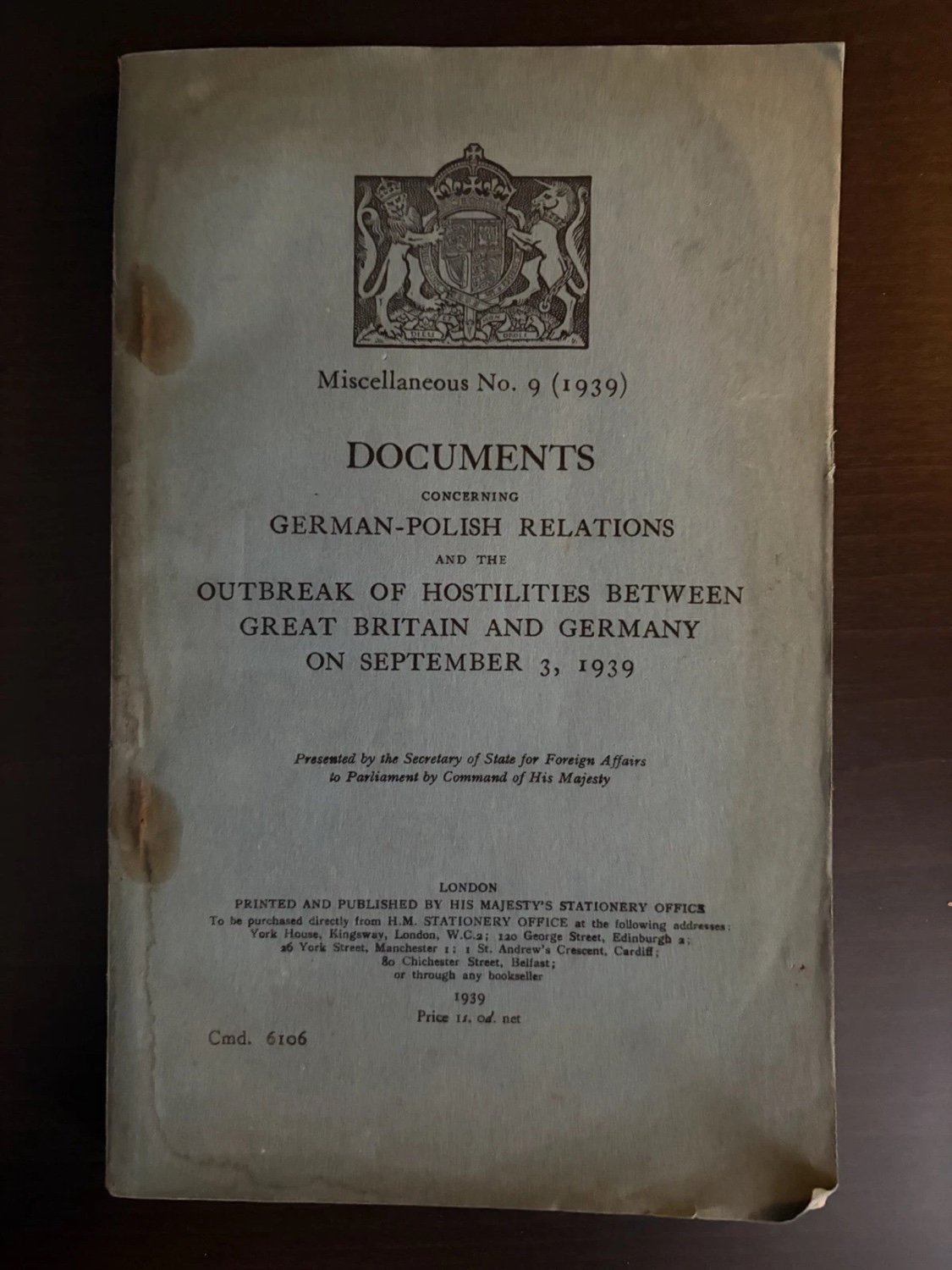
The second piece is quieter but no less striking: Command Paper 6106, a 1939 booklet entitled Documents Concerning German-Polish Relations and the Outbreak of Hostilities Between Great Britain and Germany on September 3, 1939. Its cover gives us a remarkable amount before we open it: a royal crest, the date, the formal title, the phrase “Presented by the Secretary of State for Foreign Affairs to Parliament by Command of His Majesty”, and a printed price of one shilling.
“Documents concerning German-Polish relations
and the outbreak of hostilities between Great Britain and Germany
on September 3, 1939.”
There is no need to improve on that language. It is both direct and carefully controlled: not a narrative, but documents; not a general war, but a defined relationship and a date. I find the cover moving precisely because it is so restrained. It gives the reader an official framework in which to understand a rupture that would soon overwhelm any one framework.
Its worn edges matter here. A Command Paper begins as public information, printed in numbers and intended to be handled. The softening at the corners and the marks to the pale cover are not proof of a particular reader’s thoughts, but they remind us that this was a purchasable piece of state paper, not an abstract record preserved only in an archive.
The emergency that stayed in the drawer
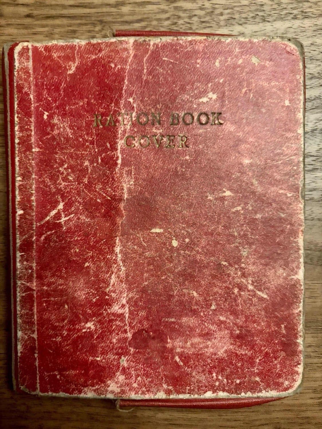
The ration books bring the subject much closer to the hand. They are dated 1952–54, not the war years themselves. That is the point. The faded red cover reads simply Ration Book Cover; the group includes Ministry of Food books and a Services Clothing Book, with serial numbers, printed instructions and names written in ink.
Seeing the dates after the date of the war is a useful corrective to the neatness of hindsight. Food rationing in Britain continued until 1954. The books in this listing belong to the last part of that long tail: paper forms of restraint surviving in a country which, in other respects, was trying to describe itself as post-war.
What interests me most is the mixture of system and person. The Ministry supplied the type, the serial number and the official boxes; somebody else supplied a name, an address, a fold, a rubbed corner and eventually the decision to keep the thing. A ration book is designed to divide and record, but it cannot help becoming individual once it has lived in a pocket or a kitchen drawer.
What I look for in wartime paper
These objects have made me wary of the word “ephemera”. It can suggest something slight or throwaway, when the point of a map, a government booklet or a ration book was often exactly the opposite. Each was a practical means of making a large system intelligible. One gave a geography, one gave an official account, one regulated an everyday entitlement.
When I look at this kind of paper, I begin with the plainest facts: the printed title, the date, the issuing body, the size, the serial number and the signs of handling. Only after that do I ask the larger question of what the item made possible. The answer will not always be dramatic. But a crease, a named cover or a printed price can be enough to turn distant history into a thing that someone once had to carry.
Bibliographical note
This note considers a Daily Telegraph War Map No. 8, the 1939 Command Paper 6106, and a 1952–54 Ministry of Food ration-book group. The reading above stays with what the objects visibly show: their titles, dates, issuing bodies, material condition and marks of use.
For wider context, The National Archives explains the wartime rationale for food control, while its account of wartime and post-war Britain notes that food rationing continued until 1954. These sources provide historical context; they do not establish the provenance of the individual books shown here.
Individual object listings may end or change. If a link above is no longer available, browse RUSTY PECHA's current finds; this journal article will remain available as the durable reading reference.