
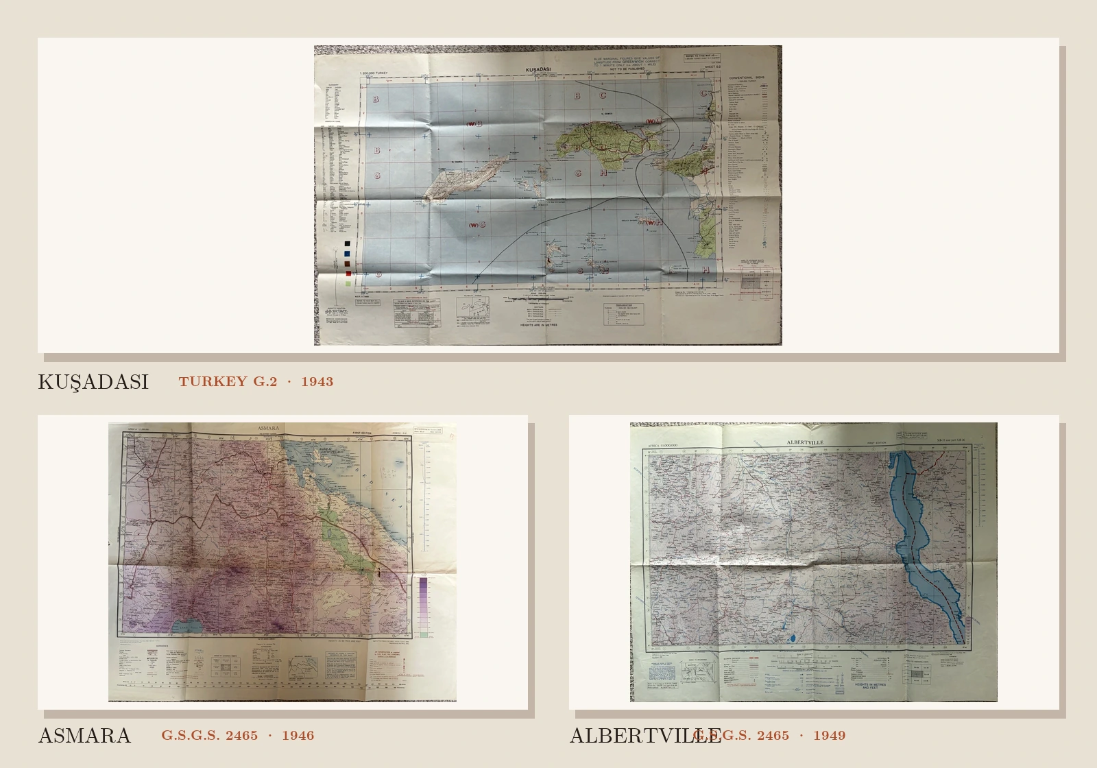
The map field is the part that raises its voice. Islands sit in blue water; high ground deepens from pink into violet; Lake Tanganyika drops through a whole sheet like a piece of cut glass. Around each of these places is a paler belt of paper. It looks secondary until one begins to read it.
The margins name the sheet, scale, edition, source surveys and symbol keys. On one copy it even says, in large capitals, Not to be published. A collector who trims the photograph to the geography can remove the strongest evidence of what the object is.
The three sheets here were printed in 1943, 1946 and 1949. They cover the Aegean coast around Kuşadası, the Asmara–Massawa region and the country surrounding the western shore of Lake Tanganyika. Their visual language is close enough to invite a general description such as “wartime military map”, but the margins show why that description is inadequate.
The sheet identifies itself before we do
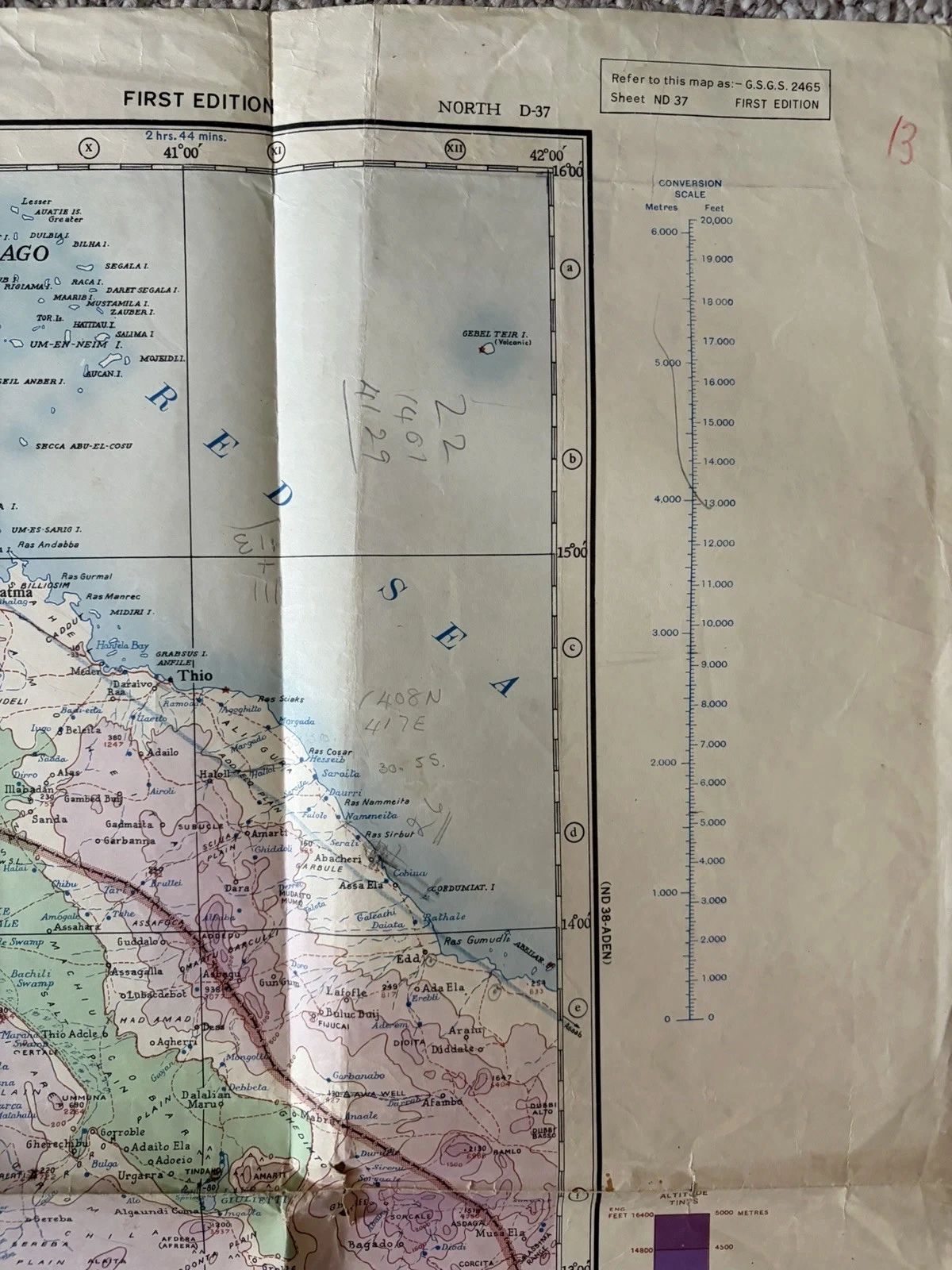
Kuşadası states its reference in a small box: 1:200,000 Turkey, Sheet G.2. Asmara asks to be cited as G.S.G.S. 2465, Sheet ND 37, First Edition. Albertville gives the same series number but a different coverage reference—S.B-35 and part S.B-36—and also says First Edition. Only the latter two belong to 2465.
This difference is not clerical fussiness. A series reference establishes the sheet’s neighbourhood: its scale, index, adjoining coverage and the conventions a trained user could expect. Kuşadası belongs to a denser Turkey grid at 1:200,000. The African sheets compress vastly larger territories at 1:1,000,000. Similar colours and War Office connections do not make those systems interchangeable.
Scale changes the sort of evidence
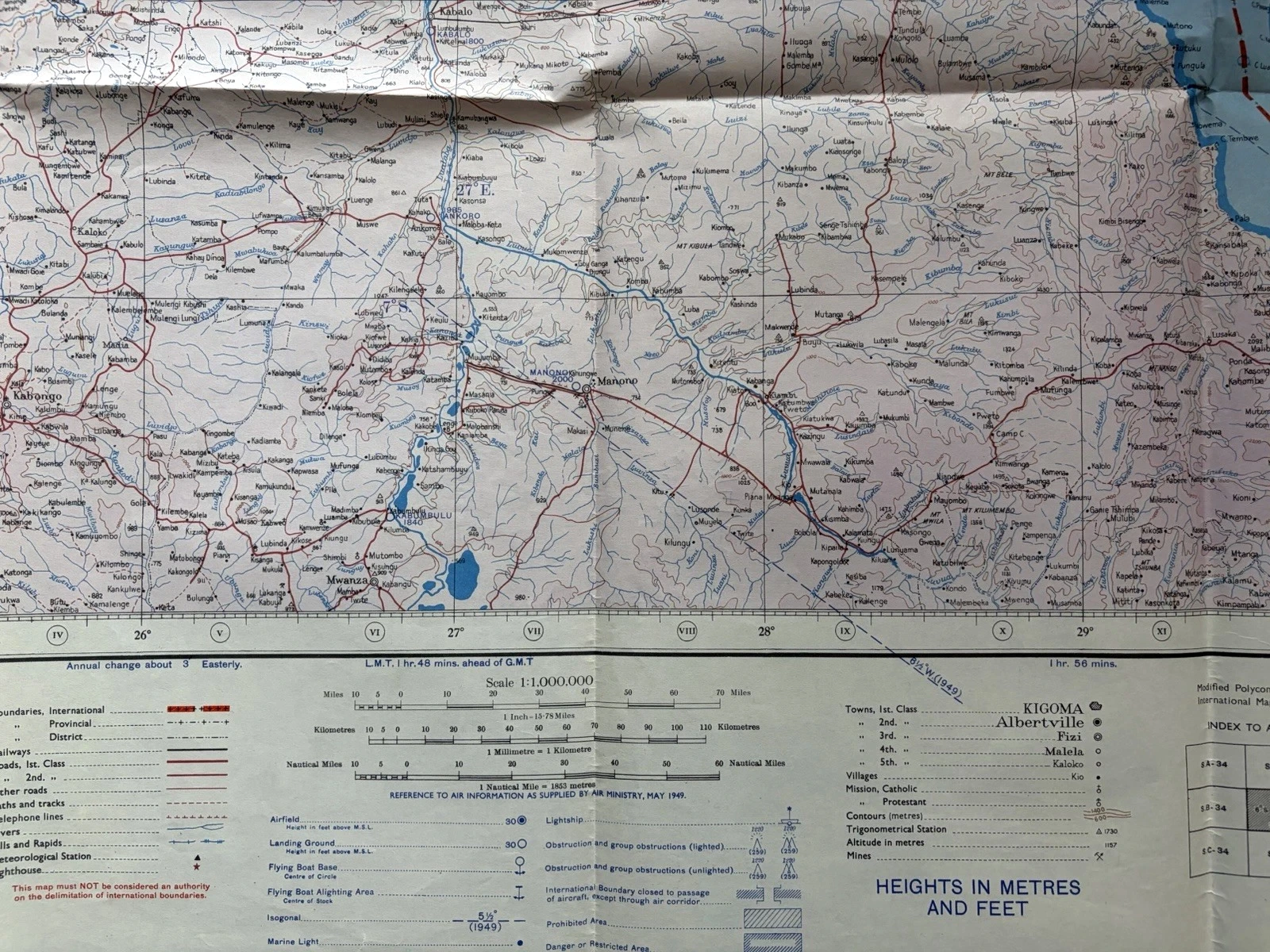
At 1:200,000, one centimetre on Kuşadası represents two kilometres on the ground. The same centimetre on Asmara or Albertville stands for ten. That fivefold change in linear scale alters what can survive the reduction. Kuşadası has room to distinguish cart tracks, bridle tracks, churches, mills, orchards, wells and individual kinds of wet ground. The million-scale sheets have to build their argument through larger route classes, settlement hierarchies, relief bands and selective aviation marks.
This is why a symbol cannot be borrowed casually from the key of another military map. A small circle, dash or patch has meaning inside one sheet’s stated vocabulary. Even when two printers use the same ink colour, the priority behind it may differ. On the Turkey sheet, blue participates in the water and coordinate apparatus. Asmara’s red air overprint arrives as a separately dated layer. Albertville shifts that aviation information into blue. Colour follows purpose, not a universal code.
The adjoining-sheet diagram is equally revealing. It admits that the object ends before the mapped system does. Kuşadası points towards İzmir, Manisa, Aydın and Marmaris; Asmara names neighbouring rectangles such as Port Sudan, Qizan, Khartoum and Harar. These modest boxes allow a loose sheet to be placed back inside an absent mosaic. For collectors, that placement is often more dependable than a broad description of the region.
The National Archives’ guide to military mapping describes the Geographical Section, General Staff as the producer of most maps used by British land and air forces in the 1939–45 conflict. It also advises searching by GSGS number and warns that surviving holdings are incomplete. The code is a route into a series; it is not proof that a particular sheet accompanied a named unit or operation.
Kuşadası: warning before landscape
The Kuşadası heading is flanked by two instructions. Blue marginal figures give Greenwich longitude “correct to 1 minute only”; below them, the publication warning sits directly over Samos. Red squares, blue crosses, large letters and sweeping black arcs pass across sea and island. Their drama invites interpretation, but a striking line is not an explanation of itself.

The right edge is more forthcoming. A long column of conventional signs distinguishes international boundary, railway, road classes, telegraph and power lines, bridges, wells, springs, salt pans, ricefields and swamps. Beneath it, an index names the Mediterranean Grid and places Kuşadası G.2 among İzmir, Manisa, Aydın and Marmaris sheets. The map teaches the reader which marks can be translated safely.
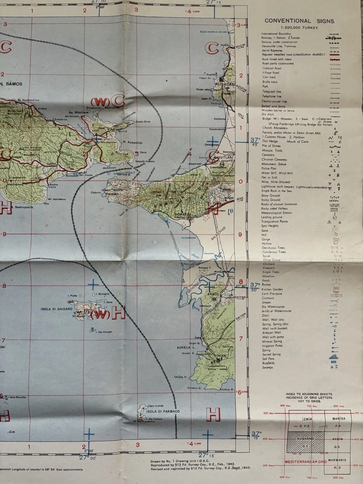
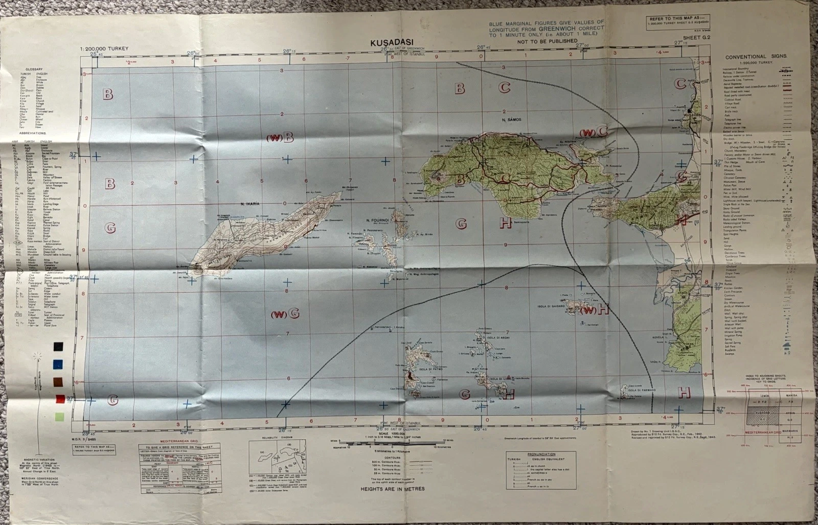
A three-line imprint provides the chronology. No. 1 Drawing Unit, I.G.S.C., drew the sheet; 512 Field Survey Company, Royal Engineers, reproduced it in February 1942 and revised and reprinted it in September 1943. “1943 map” is correct for this state, but incomplete. The paper records a sequence of work rather than one moment of creation.
Asmara: several dates on one edition
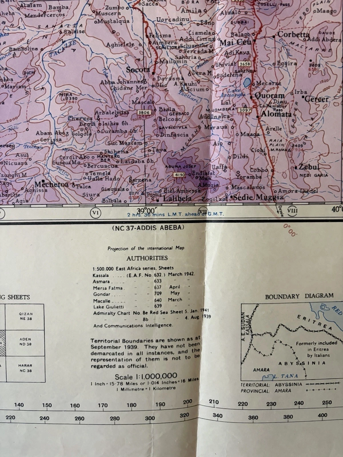
Asmara is visually richer. Hypsometric bands climb from green below sea level through brown and purple highlands. Kassala, Gondar, Lake Tana, Massawa and the Dahlak Archipelago sit within a dense mesh of road, rail, drainage and relief. The sheet box calls it a First Edition, yet the lower edge separates at least three dates.

The map was reproduced by the War Office in 1946 from a 1945 reprint of its first edition. The air information, printed in red, was supplied by Headquarters, RAF Middle East in June 1945. A listing may reasonably place the object near the Second World War, but the finished sheet is post-war. A more exact description is a 1946 War Office map carrying air data from the previous year.
Its air legend is unusually explicit. Solid and open circles separate airfield from landing ground; added marks identify uncertain locations, abandoned sites, seaplane stations and alighting areas. A line of equal magnetic variation has its own date. The centre becomes readable only after these distinctions are learned at the edge.

Another panel is a miniature bibliography. It lists 1:500,000 East Africa sheets dated 1942, Admiralty charts from 1939 and 1941, and communications intelligence. Beside it, the boundary note states that territorial lines are shown as at September 1939, have not always been demarcated and are not to be treated as official. Authority is presented with limits printed into it.
Albertville: the series continues in 1949
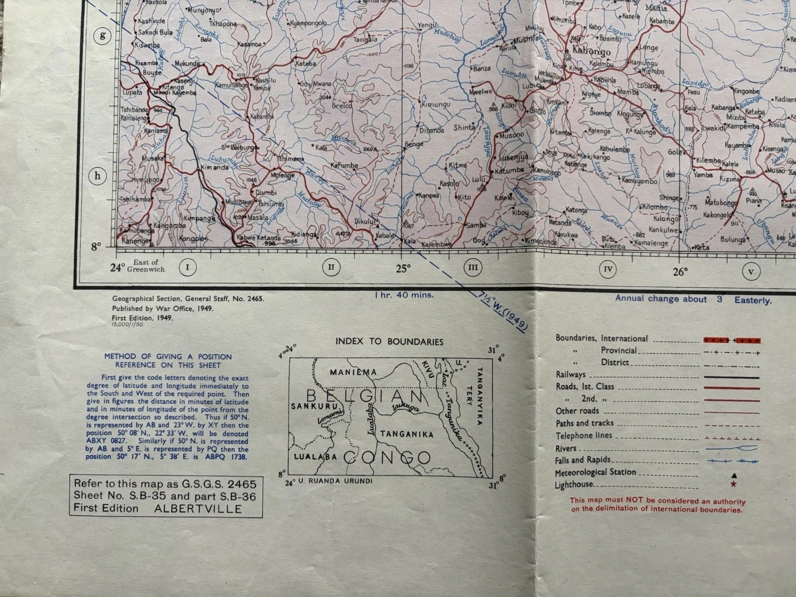
Albertville makes the dating lesson unavoidable. The title is the former name of present-day Kalemie, on the western shore of Lake Tanganyika. Across the sheet, Belgian Congo and Tanganyika are period political names. They belong to the map’s time and should not be allowed to masquerade as current geography.
The lower-left imprint reads Geographical Section, General Staff, No. 2465; Published by War Office, 1949; First Edition, 1949. Elsewhere, the sheet says it was reproduced by Ordnance Survey from a 1942 provisional Belgian Congo edition. Its blue aviation key is credited to the Air Ministry in May 1949 and includes airfields, landing grounds, flying-boat bases, obstructions and prohibited areas.

This sheet has a wartime ancestor, but a post-war identity. Its survival inside the same numbered series shows why the series must not be made synonymous with the conflict. An institutional system can outlast the emergency that expanded it. The map’s own date is the first defence against a category applied too broadly.
Marks made after the press
Asmara carries a red 13, pencilled figures and what resemble coordinate notes along the Red Sea margin. Blue numbers appear on the reverse of Albertville. Kuşadası shows stains, softened folds and local tears. None of those additions is meaningless, but none arrives with a named hand.
It is safer to describe their position, colour and medium than to invent a headquarters desk or a field mission. The annotations demonstrate use after printing; without accompanying records they do not identify the user. Folds establish a repeated method of handling; they do not tell us where each opening occurred. Physical evidence becomes most valuable when its limits are left intact.
Seven checks before the centre.
- Transcribe the exact title and the “refer to this map as” box.
- Record scale, sheet number and named grid or series separately.
- List every edition, revision, reprint and reproduction date.
- Photograph the authorities, reliability notes and adjoining-sheet index.
- Match lines and colours to the printed conventional signs.
- Date any air, boundary or magnetic information independently.
- Describe handwriting and wear without converting them into provenance.
The method is deliberately slow. It may turn one confident label into several smaller statements: Turkey G.2 rather than 2465; 1946 printing with June 1945 air data; 1949 first edition based partly on a 1942 predecessor. That is not a loss of story. It is the point at which the object begins to supply its own.
Return to the geography afterwards and the colours have changed character. A circle is no longer merely an airfield; it may record uncertainty or abandonment. A border carries a printed warning. A dramatic arc waits for an explanation rather than accepting the first one offered. The empty-looking band has done its work. The map starts before its border.
References and object notes
This article examines the photographed copies of Kuşadası Sheet G.2, Asmara Sheet ND 37 and Albertville Sheets S.B-35 and part S.B-36. Titles, scales, production lines, keys, source lists, printed cautions and condition descriptions above come from those sheets. Their listings are not used to assign an operation or owner.
The National Archives explains GSGS’s wartime role and the archival value of its reference numbers; its WO 401 map-catalogue record also shows how those identifiers continue to organise collections. An independent National Diet Library catalogue entry records another GSGS 2465 Africa sheet as War Office cartography at 1:1,000,000. These sources establish the institutional setting, not the individual journeys of the three copies.