
Turn the sheet over and the island disappears. In its place are bathing costumes, silk stockings, sandals, cigarettes and a promise that holiday films can be developed overnight. Fifteen advertisements occupy the reverse in a tight black-and-white grid. Some depend upon elegant lettering; others enlist swimmers, shoes or the authority of a testimonial. All have been made to survive a quick glance.
The surprise is not that a tourist map contains advertising. It is how completely this one divides its labour. Geography holds one side; trade takes the other. Folded together, they produce a small paper version of Guernsey in 1934, arranged for someone who needs directions but might also require a bathing cap, a camera shop or something to smoke on the journey home.
That combination gives the object its historical weight. The businesses have not merely sponsored a decorative border. Their names, addresses and products are attached to the way a visitor was expected to find the island useful.
Guernsey for the visitor in 1934
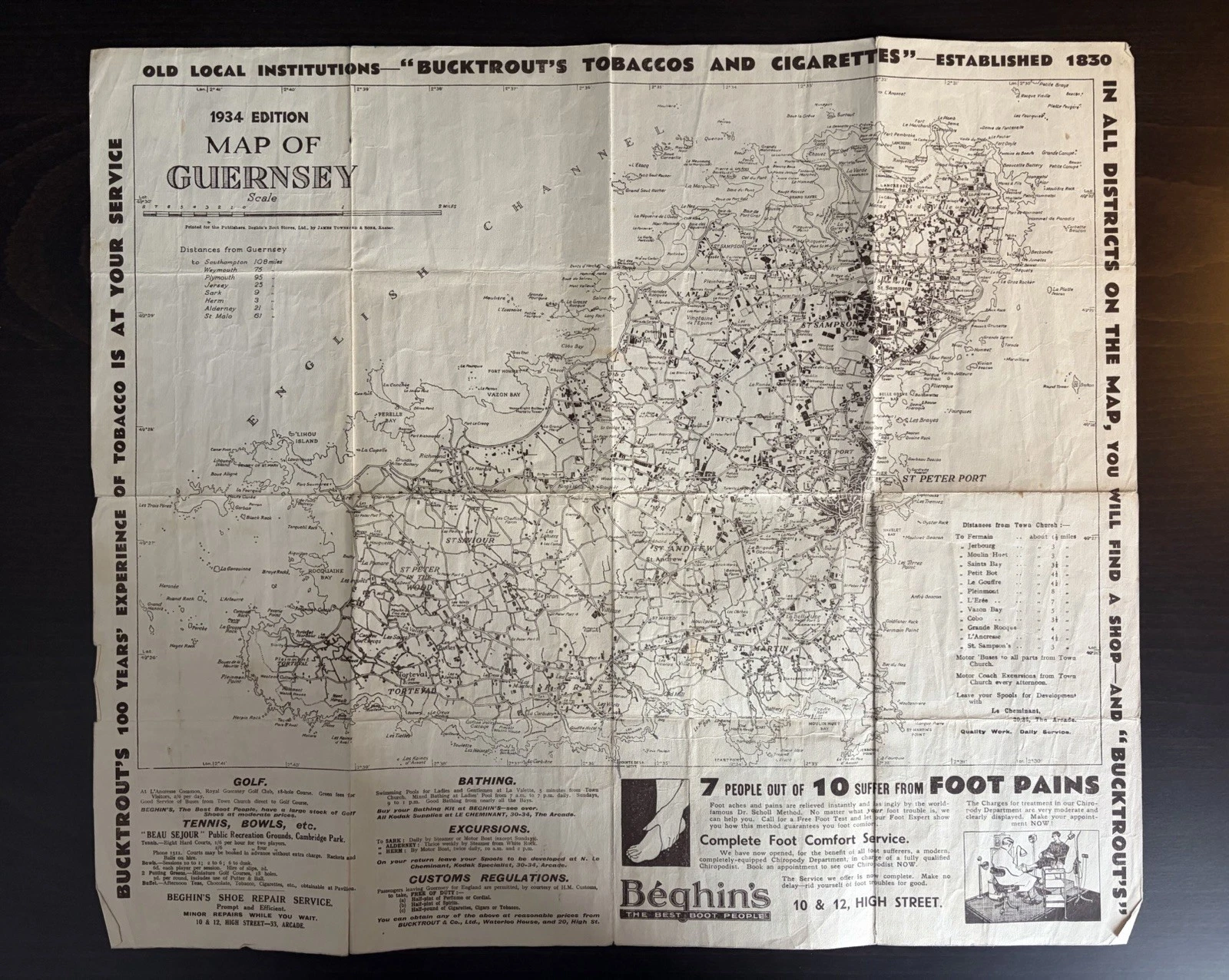
The title block is unusually generous. “1934 Edition” stands above Map of Guernsey, followed by a scale and a printer’s sentence. The sheet was printed for the publishers, Beghin’s Boot Stores Ltd., by James Townsend & Sons Ltd. of Exeter. That line establishes publisher and printer. It does not explain the financial arrangement between Beghin’s, Bucktrout or the other advertisers, and there is no reason to invent one.

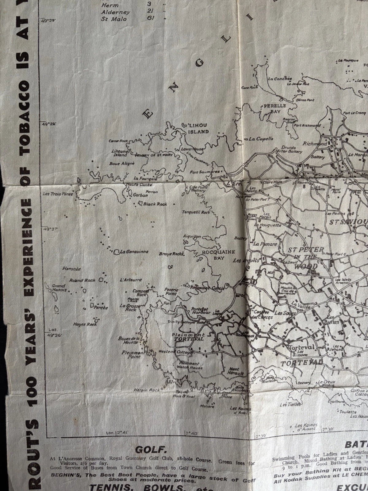
Beneath the credit, a list turns Guernsey towards the water. Southampton is given as 108 miles away, Weymouth 75 and Plymouth 95; Jersey, Sark, Herm, Alderney and St Malo complete a much nearer ring. These are not directions for walking the island. They position it as a destination reached from elsewhere, then hand the visitor to the roads and place names spreading across the sheet.
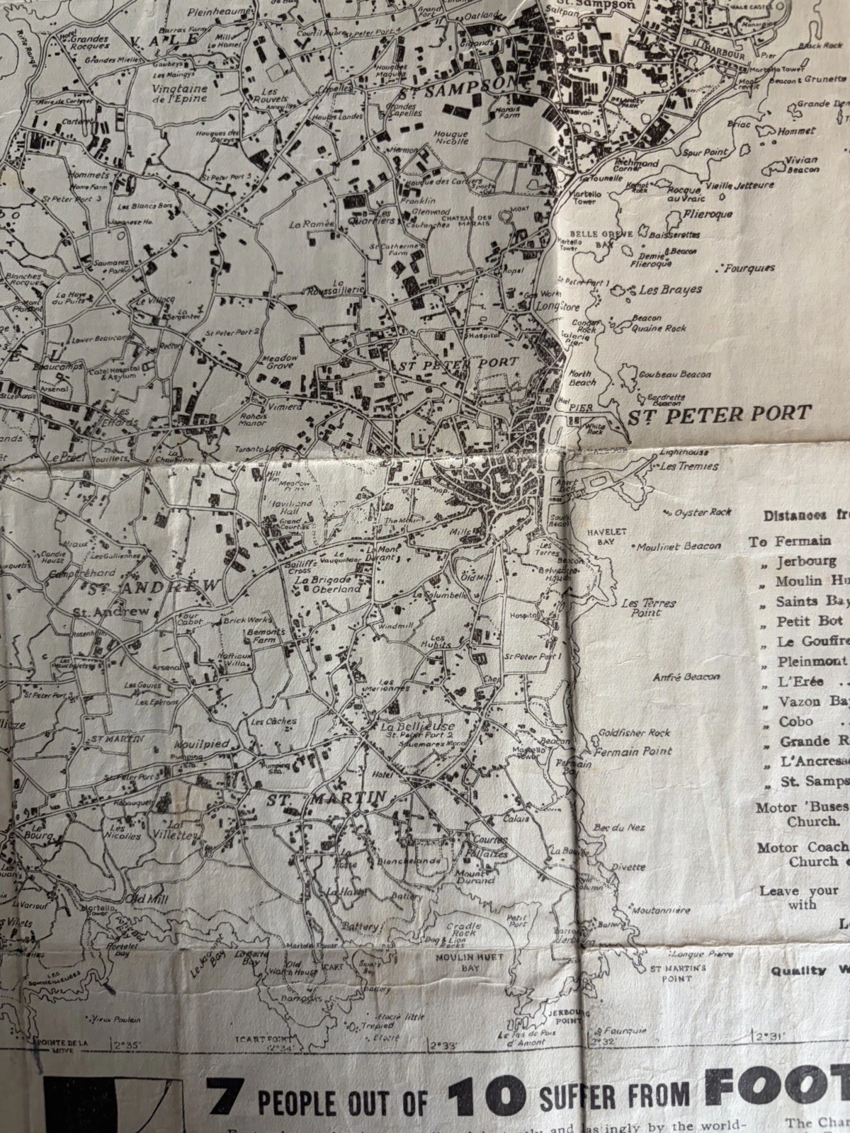
The west coast carries Lihou, Perelle Bay, Rocquaine Bay and Torteval among a close network of lanes. Around the lower edge, golf, bathing, tennis, bowls, public recreation grounds, coach excursions and customs regulations compete for space. Near St Peter Port, distances begin again from Town Church. Motor buses and afternoon coach excursions turn that point into a practical centre rather than simply another label.
A separate 168-page Guernsey tourism brochure from the same year, described by the Priaulx Library, joined maps, hotels, transport information, excursions, sport and numerous advertisements. It was produced by the States of Guernsey Advertising Committee and printed locally by the Guernsey Press Company. It is not the source of this sheet. The comparison is valuable for a narrower reason: both publications show practical visitor information and commercial publicity sharing the same interwar tourism culture.
Fifteen shopfronts printed flat
The reverse has the rhythm of a small shopping street. Beghin’s uses several panels for pure silk hose, “barefoot” Xandals, Clark’s sandals, Fleet Foot shoes and seasonal beachwear. Meridian-Viking and Forma bathing costumes introduce bodies into the layout; Kleinert’s caps reduce the same promise of modern leisure to a neat accessory. Dunlop shoes and Aristoc stockings make national product names available through a local paper address.
Two of the lower panels turn circulation itself into copy. One announces an “Insula” map; another Bucktrout advertisement offers a map of Guernsey free. Their smaller wording deserves direct examination before the distribution terms are transcribed in full, and it is not yet certain that both notices refer to this precise edition. Even with that caution, the placement is revealing. A free map could draw someone towards a counter, while the counter gave the map somewhere useful to begin its journey.

Bucktrout’s broad central panel changes pace. Under “What to smoke in Guernsey”, it lists cigarettes and tobaccos by name and price, then tells visitors how much tobacco or how many cigarettes they may take into England duty-free. The lower advertisement supplies Waterloo House in the High Street as the export and general office, with a retail branch at number 20. Elsewhere on the map face, the company calls itself an old local institution and prints an establishment date of 1830. Each statement is strong evidence for how Bucktrout presented itself in 1934; none independently proves uninterrupted trading over every intervening year.
Le Cheminant’s panel is almost a map instruction in miniature. It directs the visitor to look for Kodak signs at 30–34 The Arcade, near the bus terminus, and offers a special speed service for developing and printing. The margin beside St Peter Port repeats the invitation to leave exposed films there. Advertising and orientation meet exactly: the service becomes memorable because its address is tied to a landmark already useful to a newcomer.
Prices, slogans and product drawings can answer questions that the road network cannot. They preserve the language of footwear, the styling of swimwear, a photographic service, retail addresses and the goods thought suitable for a holidaymaker. They cannot tell us which advertisement persuaded a buyer, how many copies of the map were distributed, whether the same people owned the named concerns or how long any shop remained open. A printed claim dates a claim, not an entire company history.
The composition also records a hierarchy of attention. A tiny shoe can be understood before its price is read; a swimmer lends movement to a static panel; the long tobacco list rewards a closer look. Black ink has to separate fifteen voices without colour, so borders, white space, italic display type and the direction of illustrated figures carry more responsibility. The reverse is not a random accumulation of notices. It has been designed as a field through which the eye can travel.
The fold does more than reduce the island
The sheet is approximately 44 by 38 centimetres when open. Folded, it could be passed across a counter and carried without demanding a case. The creases divide the island into small panels and bring the advertising grid into a second arrangement on the other side. That engineering is simple and severe: every use asks the same lines to bend again.
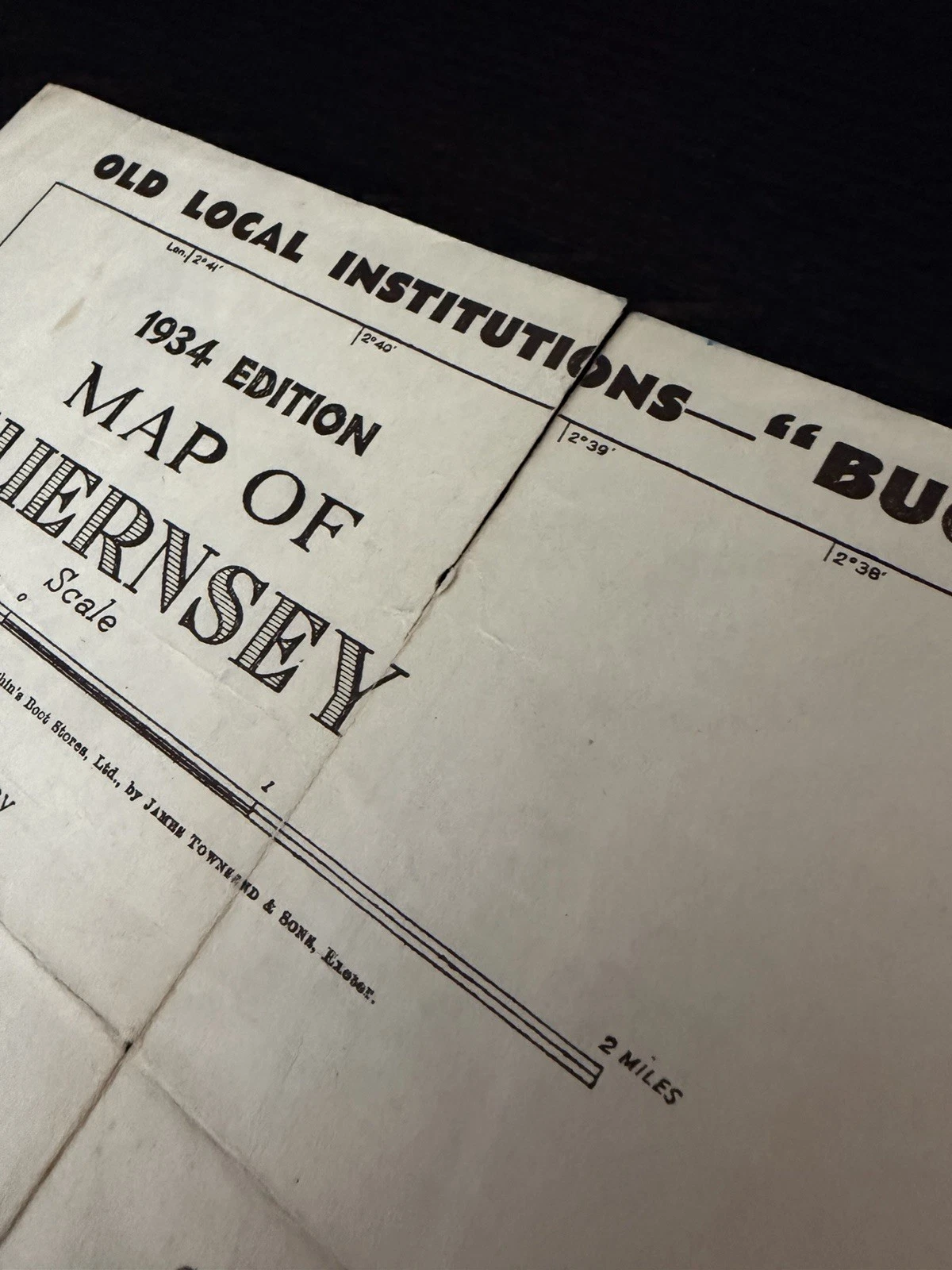
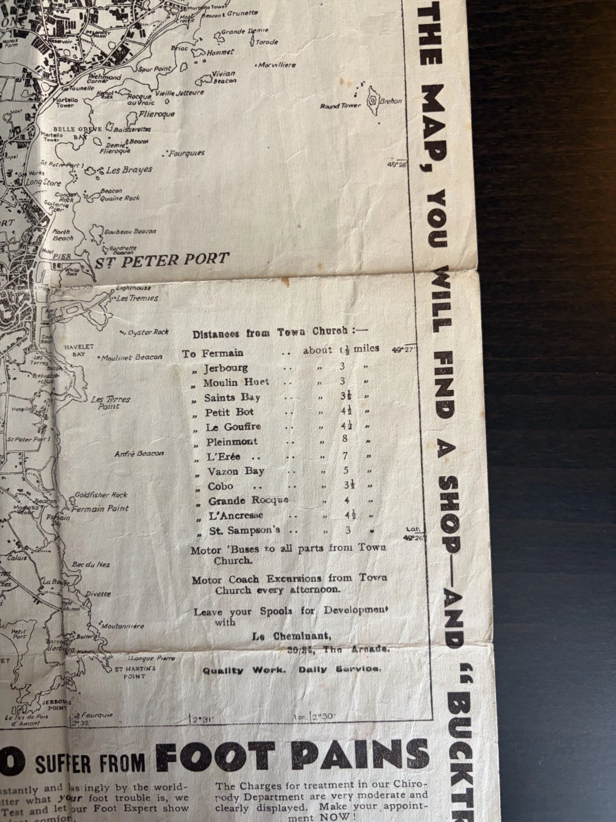
This copy retains all of its main printed field, with toning, handling marks, short wear along edges and creases, and a small hole at one fold intersection. Those features affect condition without supplying a personal itinerary. There is no named owner, no annotation fixing a particular excursion and no accompanying receipt. What survives is evidence of a format repeatedly made compact.
How to follow one advertiser
The map gives a researcher excellent beginnings because it supplies exact wording. Start by transcribing the business name, street number, product and every printer or publisher line. Separate the local retailer from the national brand named in its panel. Then compare a tight date range in trade directories and digitised newspapers, looking for the same address rather than trusting a similar surname.
From advertisement to research trail.
- Photograph both faces and every outer margin before folding the sheet again.
- Copy names, addresses, prices and product spellings exactly as printed.
- Check Guernsey trade directories for the year before and after 1934.
- Search local newspapers for matching addresses, while treating advertisements as claims.
- Compare later map issues to learn when a panel changes, without making absence prove closure.
- Record publisher and printer separately; neither alone identifies who paid for the edition.
The Priaulx Library’s Channel Islands collections include tourist brochures and trade directories, making them a sensible place to extend that search. Newspaper advertisements may help establish dates or addresses; directory entries may distinguish a retailer from a manufacturer. Neither should be used to force a neat beginning or ending where the sequence of records remains incomplete.
The advertising identifies the visitor for whom the map was produced. Golf and bathing appear in the margins; the reverse supplies shoes, swimwear and film processing.
Object and source note
The physical object is the photographed 1934 Map of Guernsey published for Beghin’s Boot Stores and printed by James Townsend & Sons of Exeter. Its title, distances, addresses, products, wording and condition descriptions have been read from the surviving sheet and its listing record.
The Priaulx Library’s account of a separate 1934 tourism brochure supplies contemporary comparison, while its collections page suggests documentary routes for future work. Neither source identifies the commission or distribution history of this map. The proposed relationship among the advertisers therefore remains limited to what their shared piece of paper can demonstrate.