
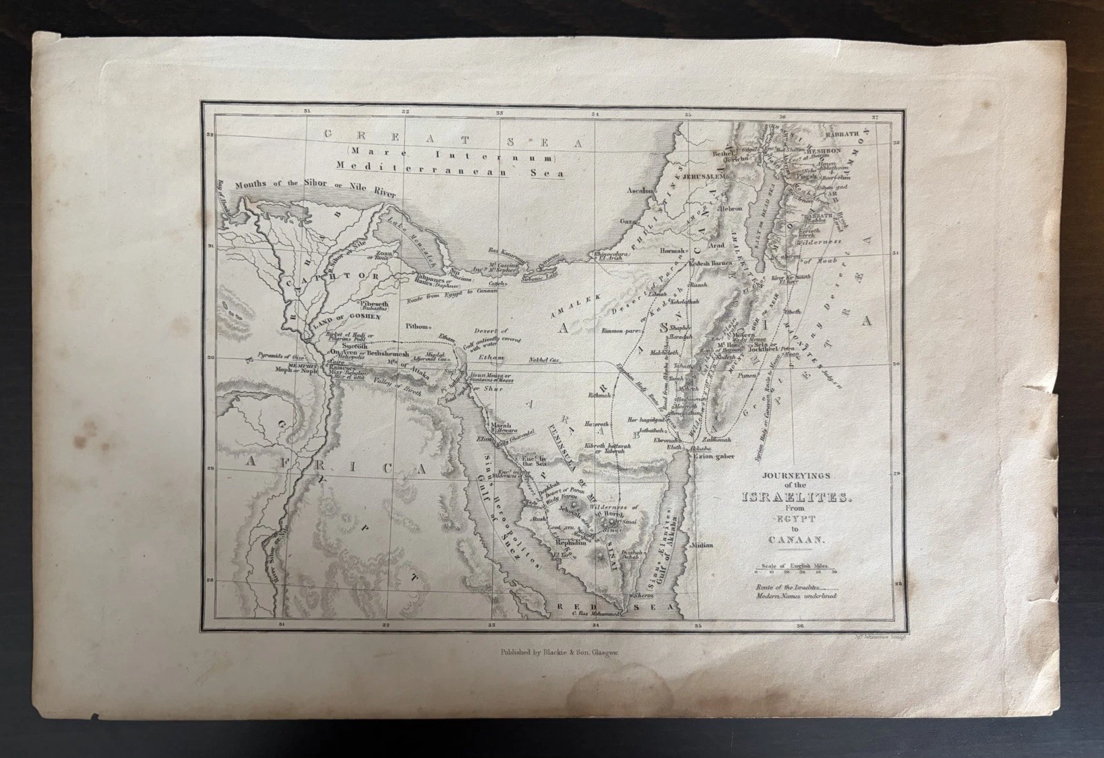
The first thing I notice is that this map does not begin with a place-name. It begins with a direction of travel. The sheet calls itself “Journeyings of the Israelites from Egypt to Canaan”, then makes the route visible as a fine line across a landscape of rivers, deserts, mountains and seas.
That small decision changes the way I read it. A conventional map asks me where something is. This one asks me to remember what happened between one place and the next.
I have always liked maps that make their subject slightly difficult. They reward a second look because the information is not all doing the same job. Here, coastlines and rivers sit beside named camps, ancient place-names and a route that is neither quite a road nor simply a boundary. The map is geography, but it is also an illustrated sequence.
A map that carries two kinds of time
The western detail is where the sheet becomes especially absorbing. The Nile mouths are carefully drawn, and the words “Land of Goshen” sit within the delta. Below them are Memphis and the pyramids; farther east, the route crosses the narrow land between the Mediterranean and the Red Sea before reaching the Sinai.
What I find most revealing is the way the map lets different kinds of time occupy the same surface. The narrative belongs to the ancient world, but the cartographic conventions are those of a later classroom or reference book: a ruled graticule, a scale in English miles and a distinction between names that are ancient and those that are described as modern.
The map does not pretend that these systems are identical. A note explains that modern names are underlined. That is a modest piece of typography, but it gives the reader a method. It tells us that the sheet is not simply reproducing a sacred story; it is trying to place that story into a geography that can be measured, compared and taught.
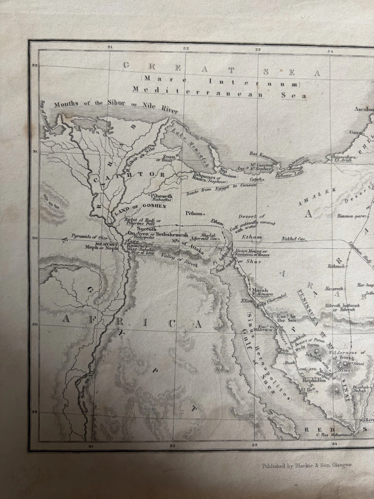
This is where I start to understand the map as an educational object. It supplies enough relief shading to suggest terrain, enough lettering to name the stops, and enough structure to prevent the journey becoming an undifferentiated sweep across the page. The hachured mountains and the open desert are not merely decorative. They create a visual pause between one stage and another.
Reading the eastern half
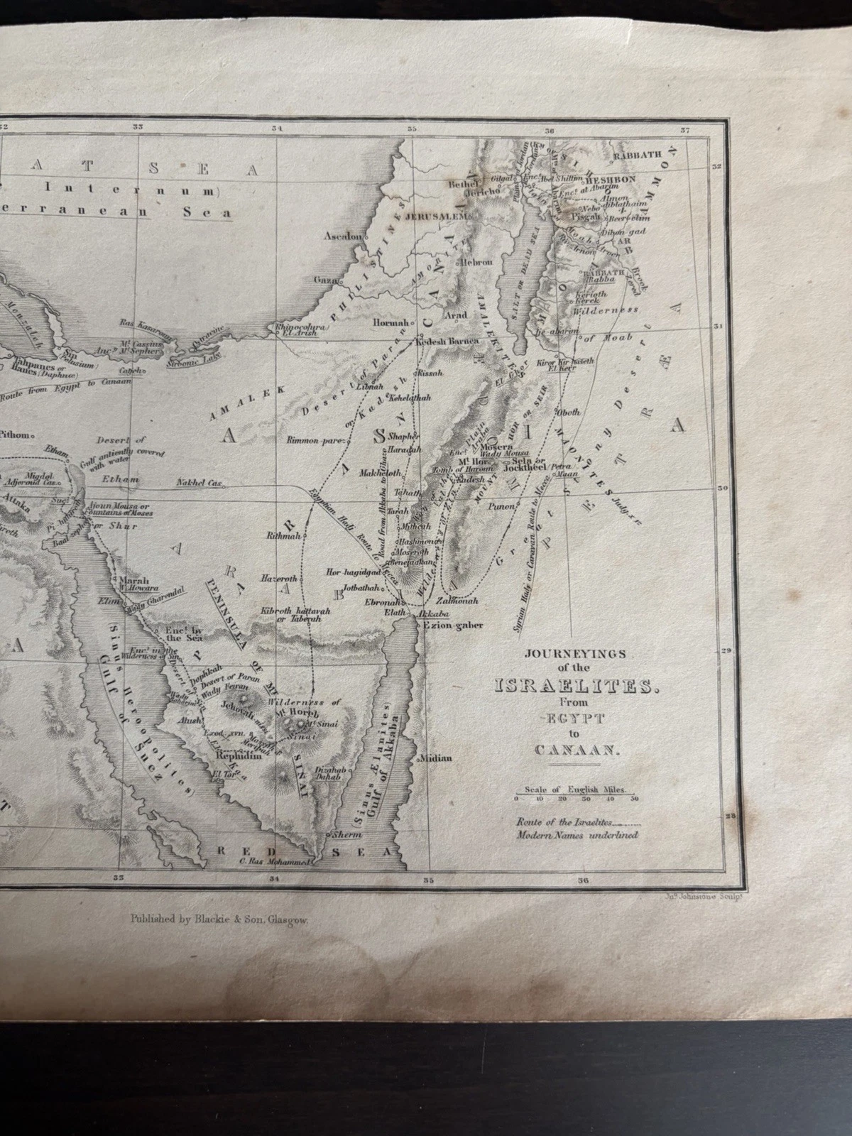
The right-hand photograph has a different kind of pull. It contains the title, but it also holds the destination in detail: Jerusalem, the coastal plain, the Dead Sea, the Jordan valley and the cluster of names across Canaan. Sinai remains visible at the lower edge, so the reader can work backwards as well as forwards.
I like that the title is placed inside the geography rather than above it. It makes the words part of the map’s argument. “From Egypt to Canaan” is not only a caption; it is a reading instruction. Start here, follow the line, and notice how the landscape changes as the line proceeds.
My partner, who is an engineer, often reminds me that a diagram becomes useful when its marks have relationships rather than merely details. I thought of that while looking at this sheet. The route line, the scale, the underlined modern names and the relief are separate systems, but they cooperate. Remove any one of them and the map becomes less sure of what it wants the reader to do.
There is also an honesty to the sheet’s limits. It does not claim to be a modern survey, and it does not give us a complete historical apparatus. Its authority comes from arrangement: this place beside that place, this name distinguished from another, this line carried across the page. The map asks to be read as a carefully made explanation, not as a neutral window onto the past.
What the route leaves behind
When I put the complete image beside the two details, I see why old maps remain so compelling even when their subject is familiar. The interest is not only in recognising Egypt, Sinai or Jerusalem. It is in watching a printed object decide how a reader should move through them.
The route is the map’s memory. It gives the sheet a beginning, a middle and a destination, but it also exposes the work of translation involved in turning a narrative into geography. Ancient names, modern names, measured distances and shaded relief all meet on one piece of paper. None of them cancels the others; each makes the reading slightly more deliberate.
That is what I would want to preserve when looking at this map as a collector. Not a grand claim about what it proves, but an appreciation of the small choices that make it teachable: the underlining, the scale, the restrained title, the route that can be followed by eye. A map can carry a story without resolving it. Sometimes its greatest achievement is to give the reader a way to keep travelling.
Source note: This editorial is based on the photographed sheet listed as Antique Biblical Map Journeyings of the Israelites Egypt to Canaan Blackie (eBay item 278085223553). The photographs visibly show the engraved title, the Egypt–Canaan route, place-names, relief shading, scale in English miles and the imprint “Published by Blackie & Son, Glasgow”. No publication date is asserted because none is legible in the supplied photographs. The listing route is Antique Biblical Map — Journeyings of the Israelites from Egypt to Canaan; if it is no longer available, the Journal remains the permanent reading route.