
A sailing ship leans into a stippled sea. Near it, a creature with a coiled tail rises from the water. The land is crowded with mountains, rivers and names set in Latin. Everything inside the neat black frame encourages an early date.
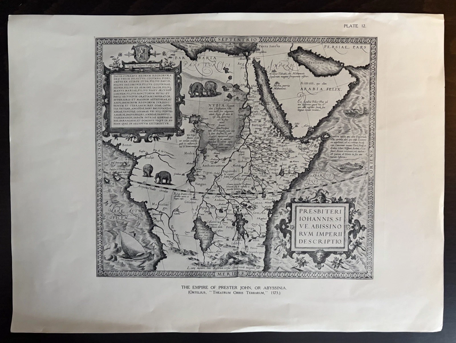
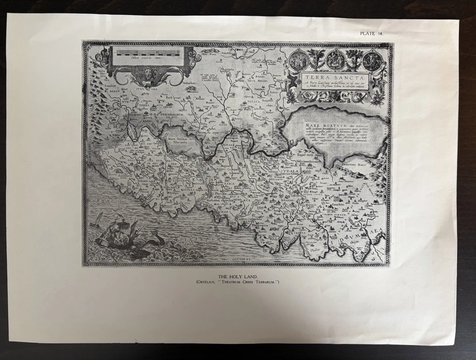
Then the eye drops below it. One leaf says Plate 12, the other Plate 14. Each carries a modern English caption in the same type. The first begins “A map of Abyssinia, the Empire of Prester John”; the second calls itself “A map of the Holy Land”. Those words do not spoil the illusion so much as explain why it was made. These are not atlas sheets printed during the lifetime of Abraham Ortelius. They are later pages made to reproduce and discuss his decorative maps.
The distinction matters because an old design can survive on much younger paper. When the two ages are collapsed into one, the object loses half its history.
The book hiding behind two loose leaves
The captions provide enough wording to search beyond the listings. Yale’s catalogue holds an entry for Arthur L. Humphreys’s Old Decorative Maps and Charts, published in London by Halton & T. Smith and in New York by Minton, Balch & Co. in 1926. It contained seventy-nine plates and was limited to 1,500 numbered copies. The plates were originally accompanied by guard sheets.
The numbering and captions of these two examples match that publication: Prester John is Plate 12; Terra Sancta is Plate 14. They are approximately 31 by 23 centimetres, printed in monochrome, and now separated from the volume that once supplied their sequence and commentary. The dark table visible around each photograph is not part of the print. The small tear at the lower edge of Terra Sancta, its handling marks and the creases on both leaves belong to the later objects we actually have.
Separation changes the way the plates are encountered. Inside the book, a reader would have moved through a declared collection under Humphreys’s title, with numbering and protective leaves keeping the examples in order. Once removed, the picture becomes more self-sufficient and the caption easier to crop away. The loose sheet can then be mistaken for the artefact it illustrates. Reconstructing the absent volume is therefore not an exercise in diminishing the print; it restores the reading conditions for which it was produced.
A classification field attached to the Terra Sancta listing calls it an “Antique Original”. The title, the printed caption and the book record all point elsewhere. That contradiction exposes a common catalogue trap: a marketplace category is not an identification. Repeated physical details across related sheets usually deserve more weight than a convenient drop-down label.
What Ortelius made new
Ortelius did not invent every geography represented in his Theatrum Orbis Terrarum. His achievement was to gather the work of other mapmakers, reshape it to a uniform format and place it within an organised publication. The Museum Plantin-Moretus describes the 1570 first edition as the beginning of the modern atlas and notes that forty-two editions appeared between 1570 and 1612. The Library of Congress emphasises the consistent copperplate sheets and the explanatory text printed on their reverse.
That publishing structure is important here. A genuine leaf from an early Theatrum belongs to a particular edition, language, paper, impression and binding history. A 1926 plate transmits the older composition through another editorial choice: which map to photograph, how large to reproduce it, how to number it and what caption to place beneath it. “After Ortelius” names a lineage; it does not give the sheet a sixteenth-century birthday.
The reverse would ordinarily be part of that distinction. Early atlas editions often carried explanatory text behind the engraved map, sometimes in one of several languages. No photograph of the backs of these leaves has been supplied. An unphotographed side cannot prove blankness, nor should lost text be imagined there. What the fronts establish is already enough: a matched modern plate apparatus surrounding reproductions of older designs.
Terra Sancta: a picture assembled from sources
The Holy Land plate is built for sustained looking. The Dead Sea dominates the lower half; place names press into the terrain; an ornamental title fills the upper right. Three circular scenes sit across the bottom, while the coast makes room for the ship and its improbable companion. Decoration, biblical history and geographical claim occupy one field without separating themselves for a modern reader.

The design itself has an earlier and more complicated ancestry. A catalogued 1608 example in the David Rumsey Map Collection credits Christian Schrot and Petrus Laicstain within an Ortelius atlas issued by Jan Baptista Vrients. A Library of Congress exhibition describes another Terra Sancta in a 1606 Theatrum, including its enlarged Dead Sea and the Jonah-and-whale scene by the coast. Those records help place the image tradition. They do not turn this detached twentieth-century impression into either institutional copy.
The sea detail is the easiest place to feel the temptation. A collector can admire the black waves, rigging, border hatching and creature while keeping the dating exact. Wonder does not require the word “original”.

Prester John: geography carrying a legend
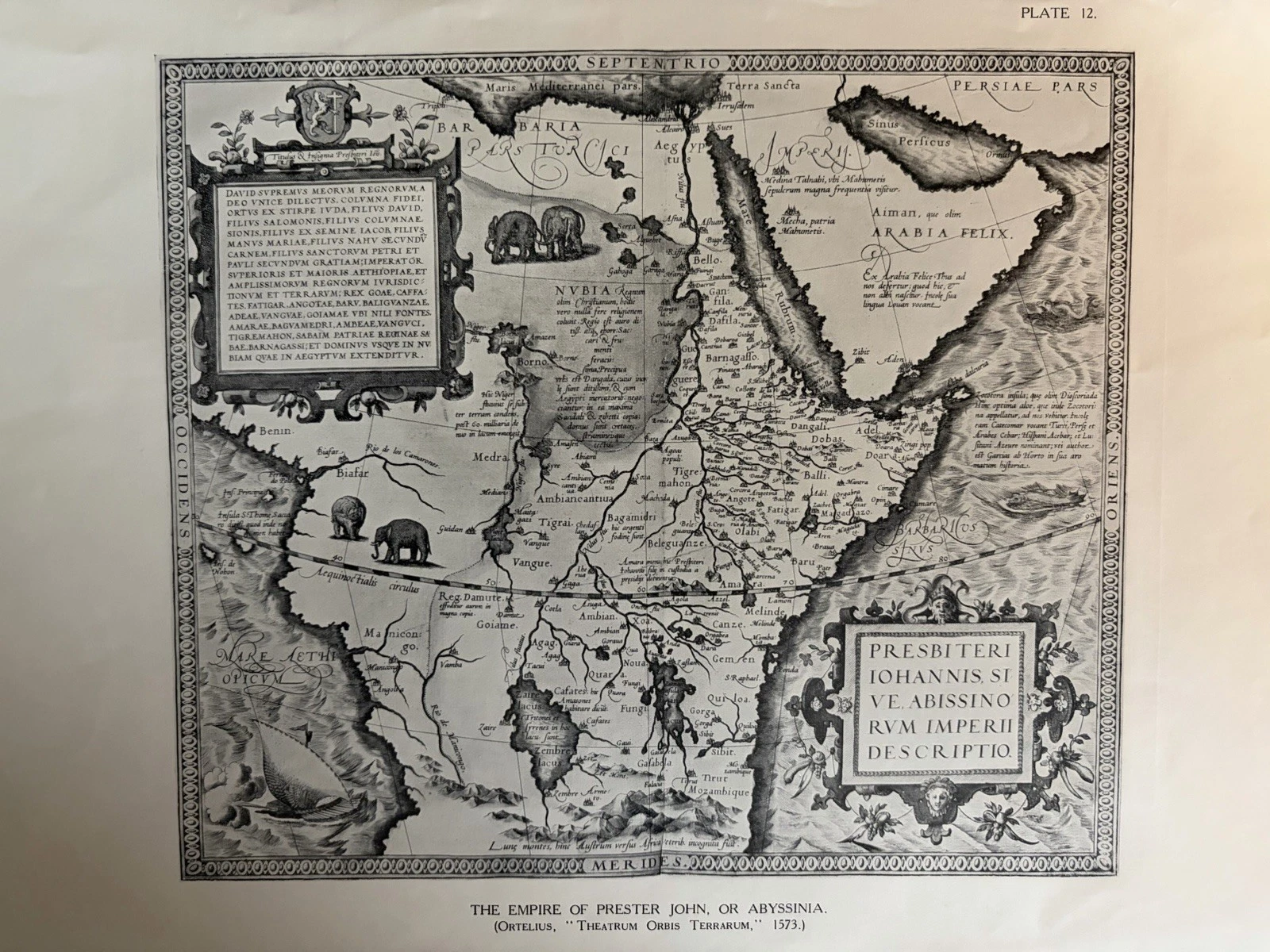
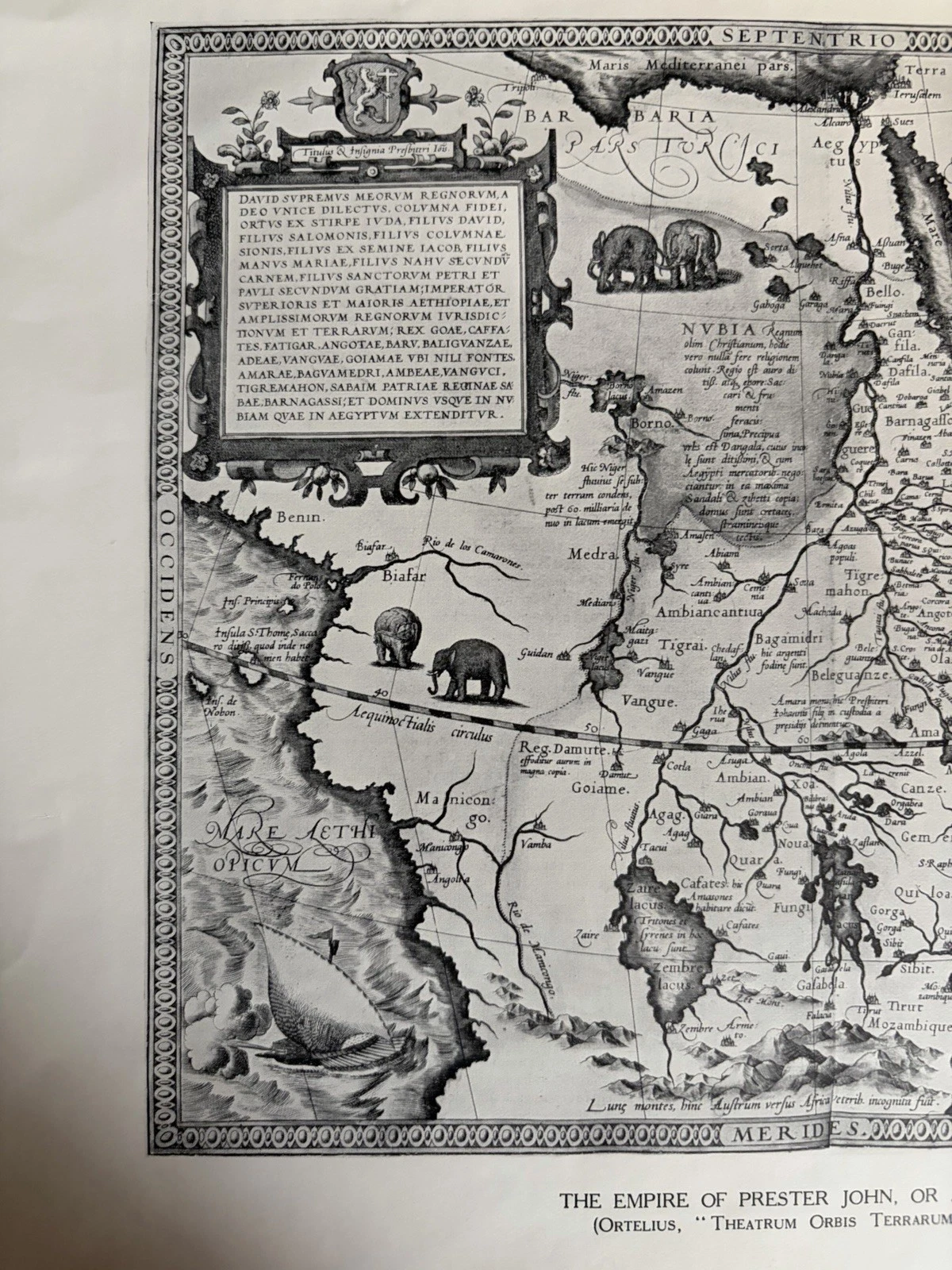
Plate 12 is frank about its model. Its English line says that the original map was published by Ortelius in 1573. Within the frame, the supposed African empire of Prester John stretches across Abyssinia and neighbouring regions. Elephants and other animals occupy the interior; mountains gather in rhythmic chains; Arabia enters at the right; a ship and another sea creature animate the surrounding water.
Prester John was a figure of European Christian legend, repeatedly moved across imagined geographies before becoming associated with Ethiopia. The map is therefore not a neutral description of Africa waiting to be decoded. It is evidence of how inherited report, religious hope, geographical knowledge and ornament could be made to agree on a printed surface. Its fascination lies partly in that unstable agreement.
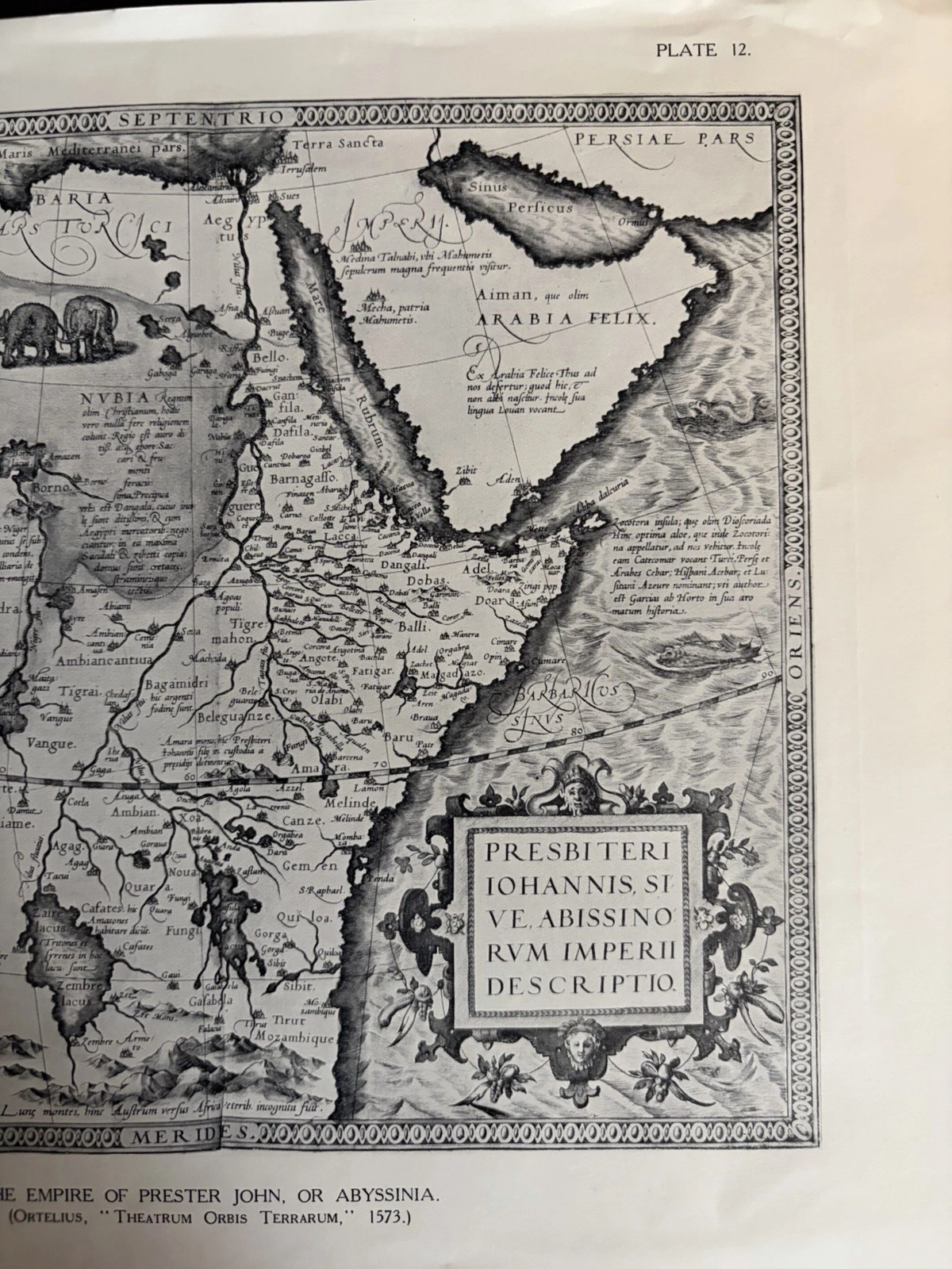
This is where correct attribution becomes more, rather than less, interesting. The page connects at least two historical moments. Its design carries a 1573 cartographic imagination; its paper form belongs to a 1926 appetite for collecting, selecting and republishing “old decorative” maps. Humphreys’s title states that taste plainly. The reproduction tells us what an interwar audience was invited to notice in an earlier atlas.
Seven checks when the image looks older than the sheet.
- Read every word beyond the map frame, including plate numbers and captions.
- Compare typography, dimensions and numbering with any companion leaves.
- Keep the source-map date separate from the printing date of the object.
- Inspect paper and printed surface in person before naming a process.
- Check the reverse, guard-sheet traces and binding edge for lost book context.
- Record trimming, tears, creases and colour without turning wear into age.
- Test the wording against a library or museum catalogue for the suspected publication.
No single clue has to carry the whole attribution. Here the pair works cumulatively: matching captions, sequential numbers, common dimensions and a catalogue record for the book. Close photographs do not reveal with certainty how the 1926 images were mechanically printed, and no reverse or surviving guard sheet has been supplied. Those questions should stay open until the material can answer them.
Printing process is an especially easy place to sound more certain than the evidence allows. A screen image can show the strength of a line and the general tone of the paper, but it cannot reliably distinguish every method used to transfer an earlier map into a modern book. Magnification of the actual surface may reveal a dot, a continuous photographic tone or another reproductive structure. Until then, “monochrome printed reproduction” is both accurate and sufficient. Precision sometimes consists of declining the narrower label.
That caution adds the history of the 1926 edition without diminishing the older imagery. The ship still sails; the animal-filled kingdom remains strange; the whale still surfaces beside the Holy Land. Now the English captions beneath them become part of the scene as well. They record a later reader deciding that these particular visions of the world deserved another life on paper.
Sources used for identification
Two detached 1926 plates are examined here: Prester John, Plate 12, and Terra Sancta, Plate 14. Their titles, plate numbers and captions appear on the sheets themselves. Listing records supply approximate dimensions, while the photographs provide the evidence for condition. Identification with Humphreys’s 1926 book rests on matching published plate information and Yale’s bibliographical entry.
The Museum Plantin-Moretus and Library of Congress establish the publishing history of Ortelius’s atlas. The David Rumsey record and the Library of Congress exhibit supply context for the older Terra Sancta design. None provides provenance for these individual copies, and no claim is made here that they retain their original place within a numbered 1926 volume.