
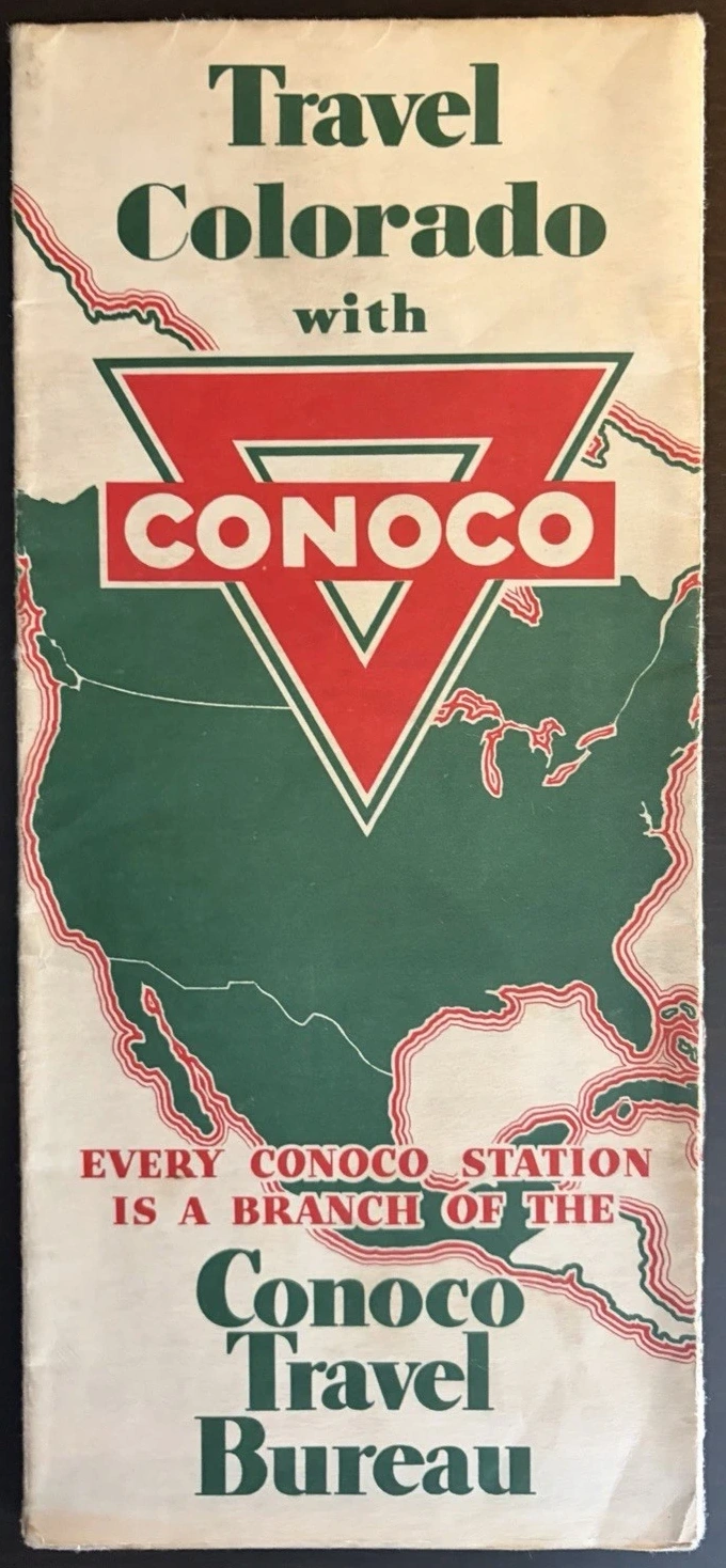
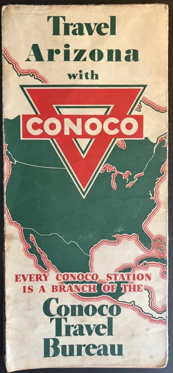
The triangle arrives before the road. Folded shut, each of these maps gives most of its surface to a red Conoco mark laid across a green outline of North America. Arizona or Colorado appears above it in large type; the words “Conoco Travel Bureau” sit below. Nothing about the cover asks the motorist to admire cartography. It asks them to connect travel with a place where fuel was sold.
I began with the covers because they are so emphatic, but the more revealing moment comes when the paper is opened. Inside are state highways, distances, parks, city streets, service-station symbols, a national network and instructions for obtaining further help. The brand is not simply printed on a map produced elsewhere. It runs through the way the journey is organised.
The two sheets are listed as an Arizona issue of 1933 and a Colorado issue of 1934, both produced by the H. M. Gousha Company of Chicago. Read together, they make a compact lesson in early motoring paper: one design language applied to different places, each place then enlarged where a driver might need something more exact.
A branch office in every station
One green panel explains the proposition in unusually direct language. It says that the Conoco Travel Bureau offered motorists a free travel service, including detailed trip plans and help through 18,000 dealer and service stations, each described as a bureau branch. Those figures and claims belong to the printed map; they are evidence of how Conoco presented the service, not an independently verified count of operating stations in a particular month.
That distinction matters because the panel does more than advertise petrol. It turns the filling station into an information point. A driver could arrive needing fuel and leave with a state map, a marked route or an address for the bureau in Denver. The sheet therefore links two kinds of confidence: confidence that the car can continue, and confidence that the person at the wheel can find the next road.

The Library of Congress describes the wider service-station map tradition in similar terms: petroleum companies commissioned firms including H. M. Gousha, branded the maps, and distributed them at filling stations to encourage travel and strengthen recognition. Its vast Peterson collection is strongest after the Second World War, so it cannot settle the precise distribution history of these earlier copies. It does, however, place their mixture of road information and oil-company identity within a well-documented collecting category.
The cover stayed still while the map moved
Set the folded sheets side by side and the repetition is almost mechanical. The same colours, continental outline and stacked typography carry the eye from one state to the next. Open them, and local decisions begin. Colorado is given a separate Denver plan. Arizona receives a substantial Grand Canyon panel. Each sheet also carries a broad United States road map, allowing the state to sit inside a longer journey rather than at its end.
This is the cleverness of the format. The outside behaves like a recognisable series; the inside changes scale whenever the motorist’s question changes. “Which state am I crossing?” calls for one map. “How do I get through Denver?” or “Where is the canyon entrance?” calls for another. Gousha supplies different cartographic answers without letting the Conoco identity disappear.
Colorado narrows to Denver
The Colorado state sheet spreads its emphasis across highways, towns, national forests, mountain ranges and a long index along the lower edge. A framed title calls it the official road map of Colorado and credits H. M. Gousha. Small triangular marks are explained as places where Conoco products were sold. The symbol turns a commercial network into a layer of geography.

Denver is treated differently. The map removes most physical geography and enlarges the street pattern. Red triangles appear along the principal routes, while a box near the top identifies the Continental Oil Building as the national headquarters and home of the Conoco Travel Bureau. Here the promotional claim becomes spatial. The bureau is not only an idea on the cover; it is placed at an address within the city it serves.

Arizona opens towards the canyon
Arizona’s main map is naturally vertical. Route 66 crosses the northern half through Kingman, Seligman, Flagstaff and Winslow, while Phoenix anchors a denser road system further south. Reservation boundaries, forests, rivers, towns and relief share the page with the same framed title and triangular Conoco key seen on Colorado. Repetition makes the differences easier to notice.

The Grand Canyon panel is not merely a larger piece of the state sheet. Its drawn relief makes the terrain the dominant fact, with rim roads, ranger stations, trails and approaches threaded around it. A red road enters from the south, while a small Conoco Bronze advertisement occupies the lower margin. Fuel promotion and scenic mapping are held together on the same face of paper.

A University of Alabama Map Library catalogue independently records a Continental Oil Company Arizona road map made by H. M. Gousha at about 1933, together with a Grand Canyon National Park component. That catalogue strengthens the proposed dating and attribution of the Arizona example. It does not prove that every surviving copy was issued in exactly the same way, and the supplied photographs do not show every printed code or marginal line clearly enough for transcription.
The road survives; the folds do not always
The Arizona sheet has worked harder than the Colorado one. Several folds have opened into splits, and one intersection has lost paper. Those weak points are not incidental to the object. A road map was repeatedly reduced, pocketed, opened in confined spaces and folded again along the same lines. Its most useful engineering feature eventually became its most vulnerable one.
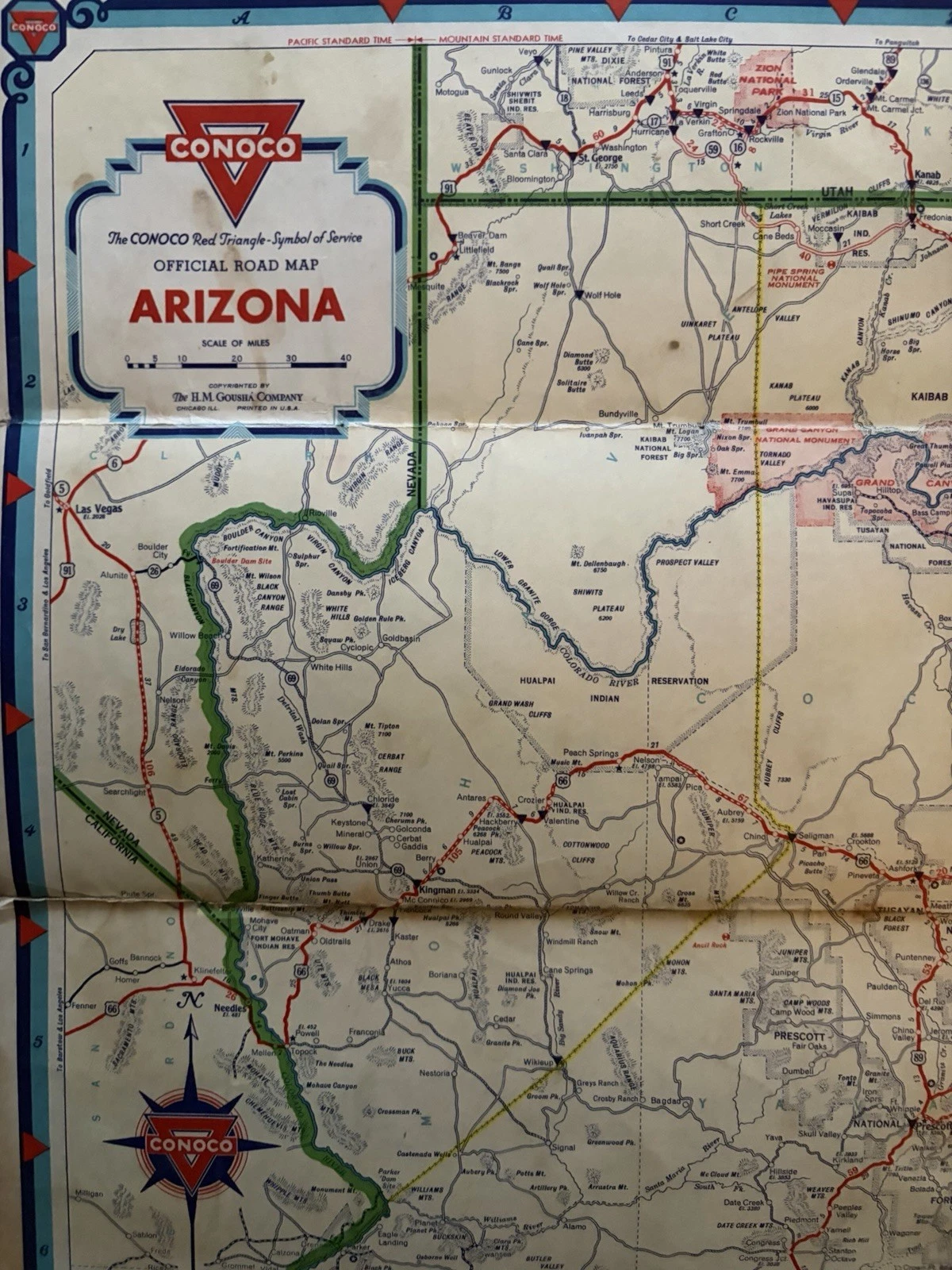
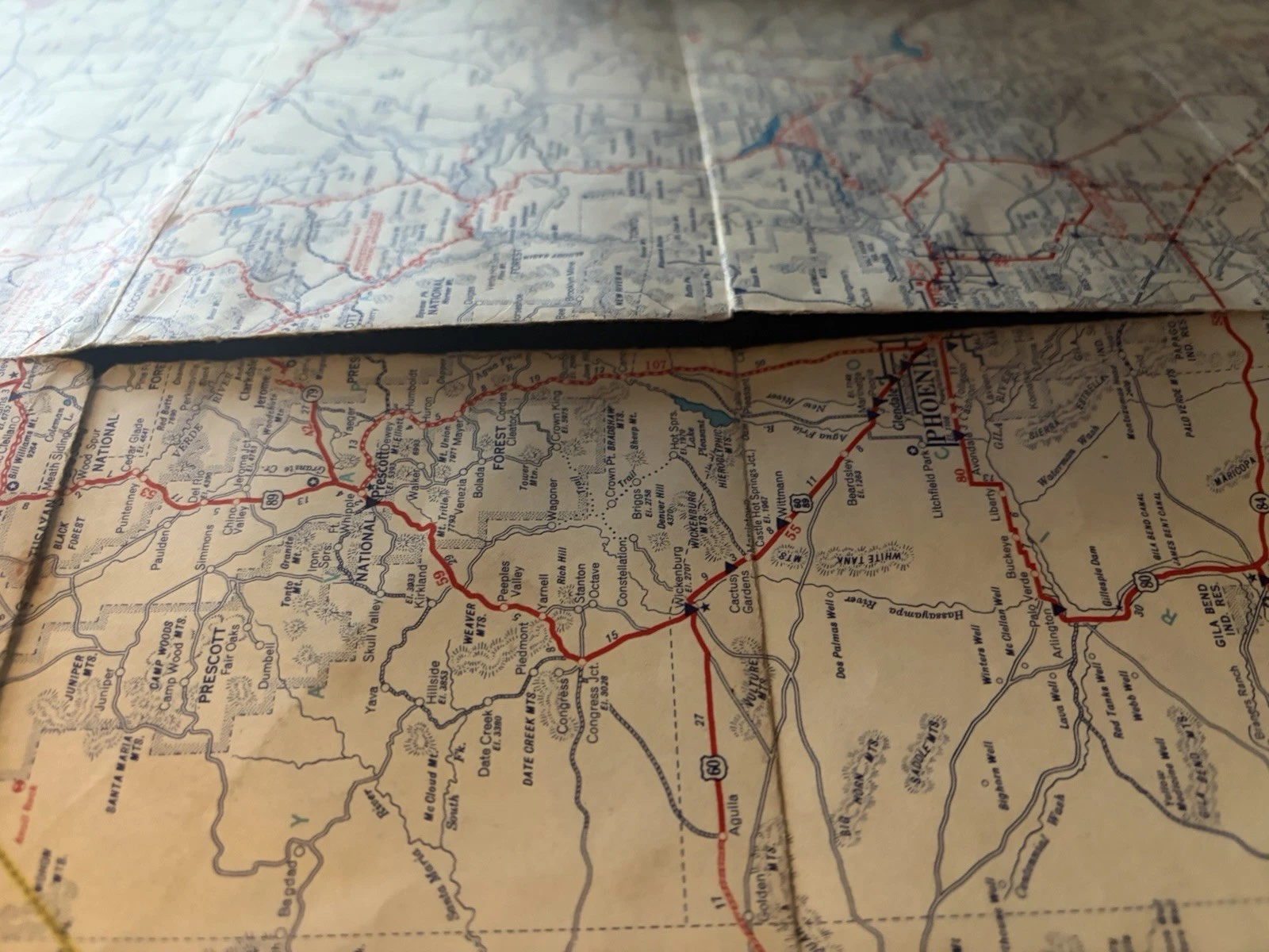
Condition should therefore be described without sentimentality and without embarrassment. The cover wear and separations reduce physical integrity; they also show exactly where the sheet was asked to flex. Cropping every damaged edge from a photograph would make a neater image and a less truthful object.
For a quick comparison, begin with four layers: the cover system; the H. M. Gousha credit and any issue code; the state legend and road hierarchy; then the special local map. Finish by checking the fold intersections. The branding may establish the family, but the margins, inset and wear identify the individual survivor.
Directions wrapped in a brand
These maps were useful because they answered practical questions. Their design is memorable because every answer returns to the same triangle. State, city, park and nation occupy different scales, yet a driver is repeatedly reminded where the paper came from and where assistance might be found.
Ninety years later, the route information is historical and the stations have changed, but the object still performs another task. It shows how motoring knowledge once reached the traveller: not through a screen already in the car, but through a folded sheet obtained at the roadside, opened across a seat and carried until its creases gave way.
Bibliographical note
This article examines two original H. M. Gousha road maps made for the Conoco Travel Bureau: Travel Arizona, listed as 1933, and Travel Colorado, listed as 1934. Their titles, station symbols, bureau wording, map content and condition are visible in the photographed copies. The issue codes and printer lines cannot be transcribed confidently from the available photographs.
The wider commercial setting is documented by the Library of Congress Charles B. Peterson III road-map collection, which records the relationship between petroleum brands, cartographic firms and filling-station distribution. The University of Alabama Map Library’s Arizona catalogue describes a c.1933 Continental Oil Company road map by H. M. Gousha with a Grand Canyon component. The Arizona Memory Project preserves an earlier 1931 Conoco Arizona sheet, useful for comparison without being treated as the same issue.